Stavanger Guide Maps | Geographic data
Stavanger, Norway N 58° 58" 15' Latitude | E 5° 43" 50' Longitude
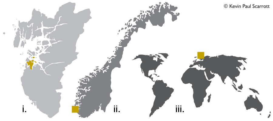
The above graphic illustrates:
i. The Municipality of Stavanger in relation to the County of Rogaland.
ii. The position of Stavanger in the country of Norway.
iii. Stavanger, Norway, in the northern hemisphere.
Stavanger Map Coordinates in Degrees:
N 58° 58' 15" Latitude
E 5° 43' 50" Longitude (City Centre: Skagenkaien)
Stavanger Map Coordinates in Decimal Values:
58.970833° Latitude
5.730556° Longitude (City Centre: Skagenkaien)
WGS84: 58° 57 48 N, 5° 43 8 E (58.963333, 5.718889)
UTM/UPS: 32N 311341 6540600
MGRS: 32VLL1134040599
County: Rogaland
District: Jæren
Municipality: NO-1103
Administrative centre: Stavanger
Official language form: Norwegian (Bokmål)
Area: Total 71 km² Land 68 km²
Percentage: 0.02 %
Population: 144 877 (Latest figures from 30 September 2021)
WHERE IS STAVANGER IN RELATION TO ...
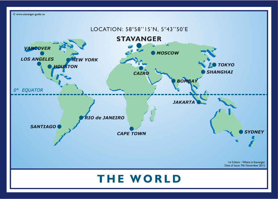
The World?
Click the image to download map in PDF-format.
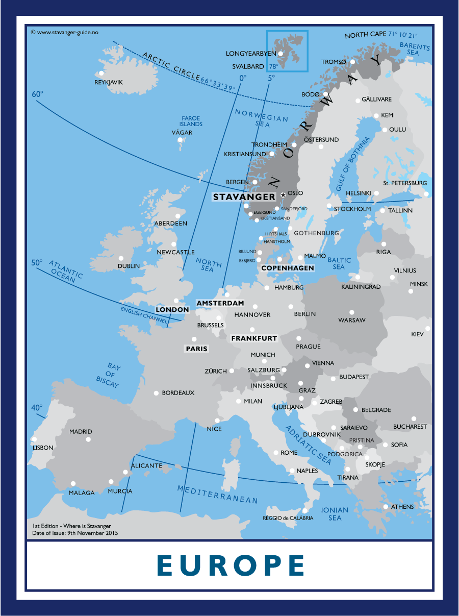
Europe?
Click the image to download map in PDF-format.
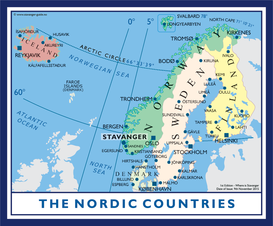
The Nordic Countries?
Click the image to download map in PDF-format.
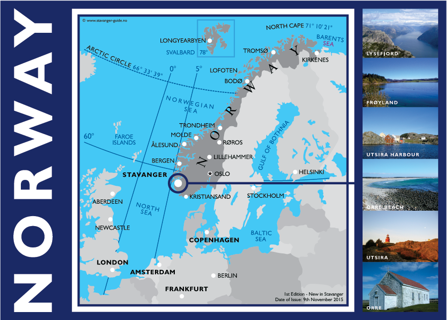
Norway?
Click the image to download map in PDF-format.